151 BURNSIDE DRIVE
Owner Information
ANDERSON, NATHANIEL
151 BURNSIDE DRIVE
SWANSEA, MA 02777


Property Details
151 BURNSIDE DRIVE is classified as a Single Family Residential (Ranch).
The primary structure on this property was built in 1972. There are 1,778ft2 of built area within this property. There is 1,316ft2 of residential/living space within this property. This property is listed as having 6 rooms.
151 BURNSIDE DRIVE is valued at $276,100. The land is valued at $106,000 and the structures are valued at $168,500. There is an additional valuation of $1,600 on this property.
This property is in Zone R1. Confirm with local Zoning Board authorities to ensure there are no overlays or other easements on this property.
The most recent deed for 151 BURNSIDE DRIVE is recorded at the local registrar in Book 10097, Page 1. 151 BURNSIDE DRIVE was last sold on Friday, May 8, 2020 for $295,000.
Assessment data from fiscal year 2021.
Flood Data
According to the FEMA National Flood Hazard Layer, this property does not appear to be in a flood zone. It may also be in an area not yet reviewed. Nonetheless, confirm this information prior to taking any action.
To view the flood hazards around this property, create a FEMA "Firmette" Map of the area around 151 BURNSIDE DRIVE.
Broadband Internet Providers
| Provider | Type | Bandwidth (mbps) | |
|---|---|---|---|
| HughesNet | Satellite | 25 | 3 |
| GCI Communication Corp. | Satellite | 0 | 0 |
| T-Mobile | Fixed Wireless | 25 | 3 |
| Comcast | Cable | 1000 | 35 |
| Verizon New England Inc. | DSL | 5 | 0 |
| Viasat Inc | Satellite | 100 | 3 |
| VSAT Systems, LLC. | Satellite | 2 | 1 |
Broadband service provider data from December 2020.
Adjacent Properties
- 159 BURNSIDE DRIVE
Single Family Residential owned by CUSTODIO HARDY & COSTA CHRISTINE JT - 23 GLEN ROAD
Single Family Residential owned by LOPES JOSE F AND THERESA A - 145 BURNSIDE DRIVE
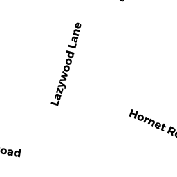
Single Family Residential owned by CORDEIRO MICHAEL & MARIA - 3 LAZYWOOD LANE
Mixed Use (Primarily Residential, some Commercial) owned by CROWLEY WILLIAM E AND MELANIE A